
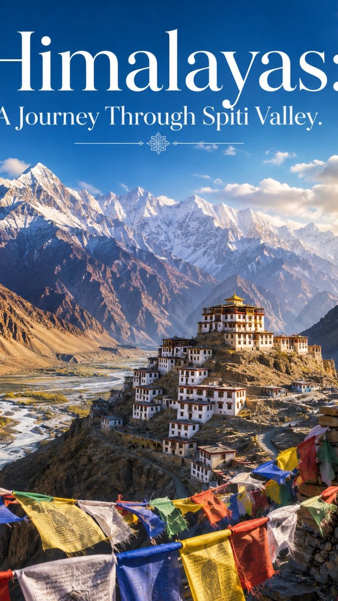
Spiti Valley Trip: Key, Chandratal & Kunzum Pass
You'll go up slowly, and that's the part that decides everything. Spiti sits at 12,000 to 14,000 feet, and the people who arrive sick are the ones who rush it from the Manali side in a day. This journey climbs the other way — Shimla in, Manali out — so you gain height gradually and your body keeps up. Eight days, from apple country to a cold desert behind the Himalayas.
You'll leave Shimla and follow the old Hindustan–Tibet Road along the Sutlej to Kalpa, where the Kinner Kailash massif catches the first light. Green Kinnaur hardens into bare ochre rock as you cross into Spiti, past the little lake at Nako and the mummified monk at Gue. You'll sit in the thousand-year-old assembly hall at Tabo, one of the oldest working monasteries in the Himalayas, its mud walls painted since 996 CE. You'll climb to Dhankar, a monastery clinging to a crag above two rivers, and detour into the greener Pin Valley before reaching Kaza, your base in the heart of the valley.
From Kaza comes the day it's all built toward: Key Monastery stacked like a fort on its hill, the highest bridge in Asia at Chicham, and the high villages — Langza under its giant Buddha, with marine fossils in the hills; Hikkim and the world's highest post office; Komic, near the highest motorable village on earth. Then over Kunzum Pass at 4,590 metres to Chandratal, the crescent moon lake, where the night sky is like nothing at sea level. The last day drops you through Batal and the Atal Tunnel into Manali, with a buffer day held back because Spiti's roads run on the mountain's terms, not yours.
You'll eat siddu and rajma in Kinnaur, thukpa and momos and butter tea higher up, and dhaba food at Batal that's an institution. Come between mid-June and mid-October, when Kunzum is clear — September best of all, when the crowds thin and the valley turns gold. What you won't get is anywhere in a hurry. Spiti doesn't allow it, and that's the whole point.
You'll leave Shimla and follow the old Hindustan–Tibet Road along the Sutlej to Kalpa, where the Kinner Kailash massif catches the first light. Green Kinnaur hardens into bare ochre rock as you cross into Spiti, past the little lake at Nako and the mummified monk at Gue. You'll sit in the thousand-year-old assembly hall at Tabo, one of the oldest working monasteries in the Himalayas, its mud walls painted since 996 CE. You'll climb to Dhankar, a monastery clinging to a crag above two rivers, and detour into the greener Pin Valley before reaching Kaza, your base in the heart of the valley.
From Kaza comes the day it's all built toward: Key Monastery stacked like a fort on its hill, the highest bridge in Asia at Chicham, and the high villages — Langza under its giant Buddha, with marine fossils in the hills; Hikkim and the world's highest post office; Komic, near the highest motorable village on earth. Then over Kunzum Pass at 4,590 metres to Chandratal, the crescent moon lake, where the night sky is like nothing at sea level. The last day drops you through Batal and the Atal Tunnel into Manali, with a buffer day held back because Spiti's roads run on the mountain's terms, not yours.
You'll eat siddu and rajma in Kinnaur, thukpa and momos and butter tea higher up, and dhaba food at Batal that's an institution. Come between mid-June and mid-October, when Kunzum is clear — September best of all, when the crowds thin and the valley turns gold. What you won't get is anywhere in a hurry. Spiti doesn't allow it, and that's the whole point.
153
Stops
Home
MomentKaza

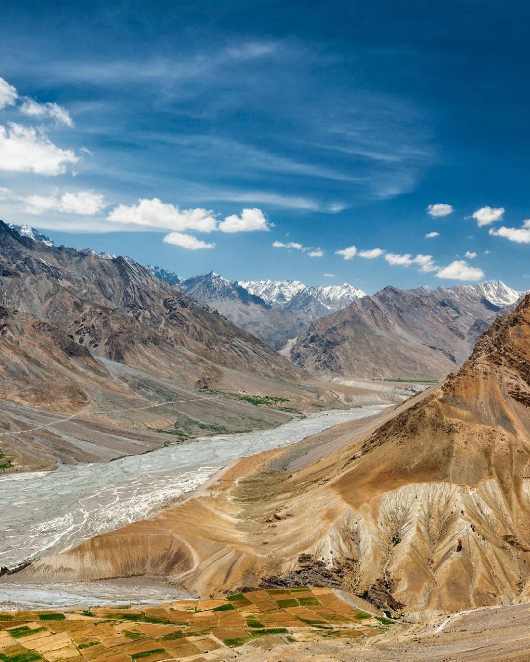
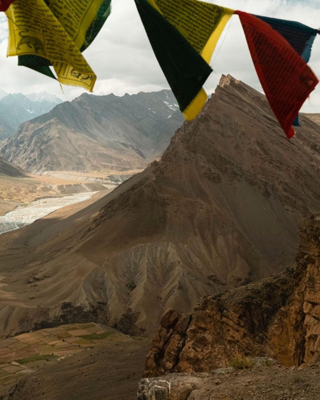
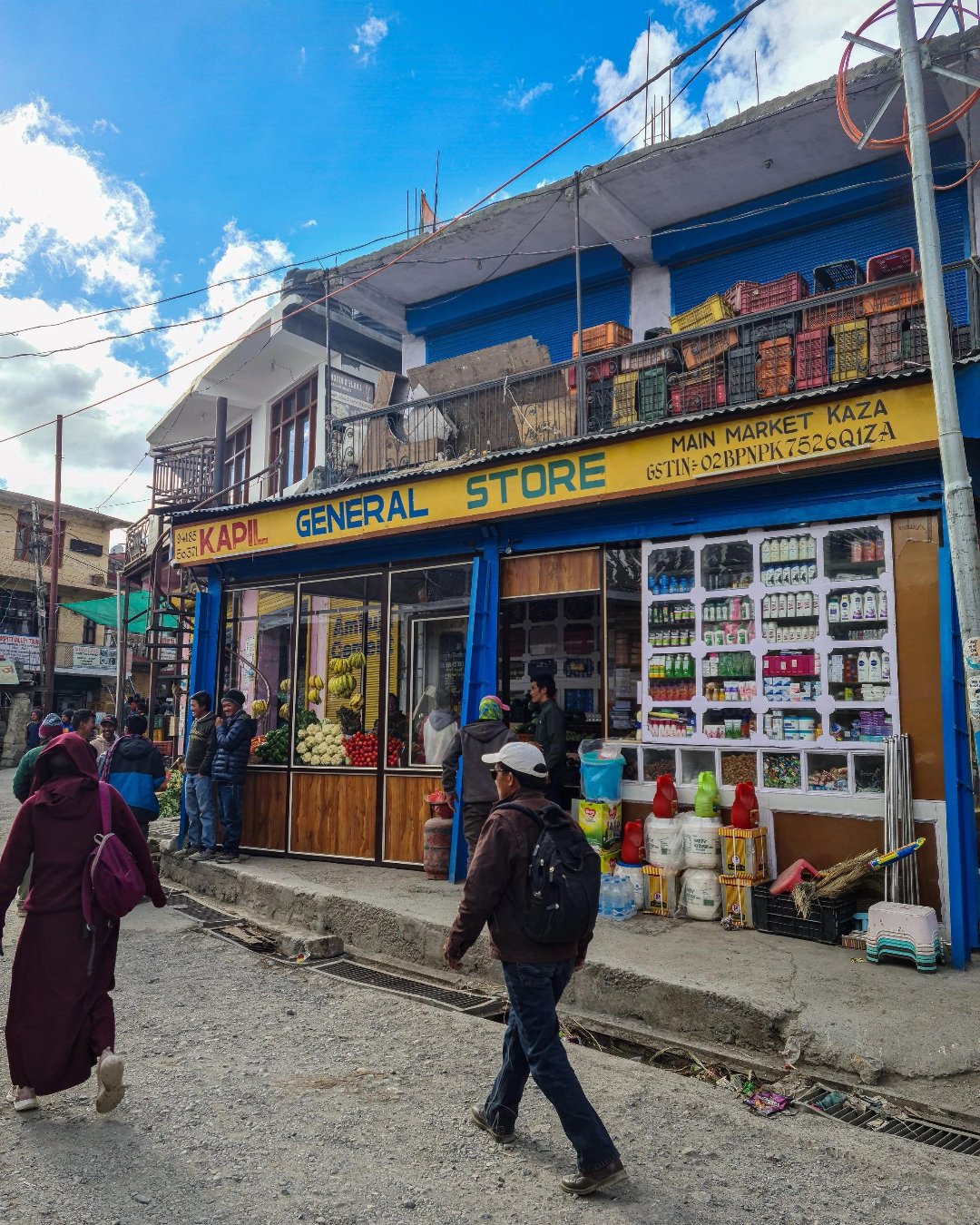
Welcome to Kaza – The Heart of Spiti
You've probably pencilled Kaza in as a bed. The town in the middle of the map, the place you sleep between the monasteries and the high villages, a night or two of wifi before the real stuff. But here's the thing nobody tells you: Kaza is the one place on this trip you shouldn't rush. Blow through it in an evening, drive straight up to Komic and Kunzum the next morning, and you'll spend the best day of your trip with a splitting altitude headache — or discover past the last pump that nobody topped up the fuel.
Let's fix that. Here's how Kaza actually works, and how to get it right the first time.
Why you slow down here, of all places
Kaza sits at 3,650 m, and everything above it — Langza, Hikkim, Komic, Kunzum, Chandratal — is higher. Your body needs a night, ideally two, at this height before it goes up again, and Kaza is where that happens. This isn't a rest day you're indulging in; it's the acclimatisation that keeps the high day from being miserable.
It's also the valley's only real town — the subdivisional HQ, and your last dependable fuel, cash, network and supplies before the wild stretch to Manali. What you don't sort out in Kaza, you don't sort out.
What you'll actually find
Kaza is two halves split by a stream: the old town, climbing the hillside, and the new town with the market and the bus stand. Worth your time:
Sakya Tangyud (Kaza Gompa) — the town monastery, and the newer Sakya complex above it.
The cafés — genuinely good, and the social heart of the town. Himalayan-style kitchens doing everything from Israeli food to local thalis.
The market — where you buy your Langza-fossil-free souvenirs, seabuckthorn juice, and warm layers you didn't pack.
The fuel pump — the highest retail pump in the world, and the only reliable one in Spiti. This matters more than it sounds.
The King's Palace at nearby Kyuling — a quieter detour if you've got an hour.
Carry cash out of Kaza — the ATMs here are your last, and they're often out of service or out of money, so draw more than you think you need.
And this is the one stop where you do pull the phone out. Everywhere else in Spiti you're happily offline; here you've got signal (BSNL and postpaid, mostly). Travellers who've done this trip will tell you the same thing: use Kaza to message home that you're about to vanish for three days, download your offline maps, and back up your photos. Past here, you're on the mountain's terms — which, once you've told everyone, is exactly where you want to be.
Pro tip: Do your admin in Kaza, deliberately and all at once — fuel to full, cash drawn, permits checked, water and snacks stocked, warm layer bought if you're cold. Then spend the rest of the day doing nothing strenuous: a slow café afternoon, a short walk to the monastery, early to bed. The single best thing you can do for the high-village day is an easy, well-hydrated day before it.
The mistakes that ruin it
Most first-timers trip over the same few things. They treat Kaza as a stopover and race up to the high villages unacclimatised. They skip the fuel or the cash and get caught out past the last pump. Or they fill the "rest" day with a hard hike and undo the whole point of stopping.
The easy fix is to let Kaza be exactly what it's for — a slow day that sets up everything above it.
Ready to see it for yourself?
Kaza is the moment most travellers underrate and then rely on. Get the acclimatising, the fuel and the cash right, and everything above it is effortless.
Want it handled end to end — the right two nights, the supplies sorted, nobody caught short past the last pump? Browse our Spiti Valley Tour Packages, where Kaza sits at the centre, along with Key Monastery, the high villages, Kunzum Pass and Chandratal. Pick your dates and we'll take care of the base.
29
MomentKey

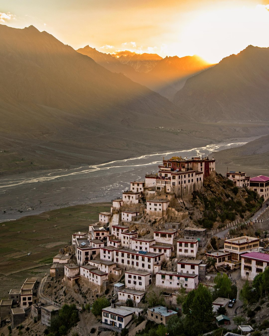
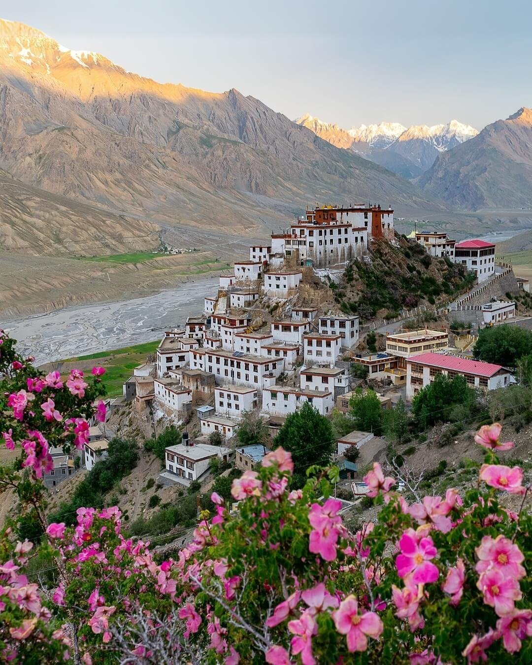
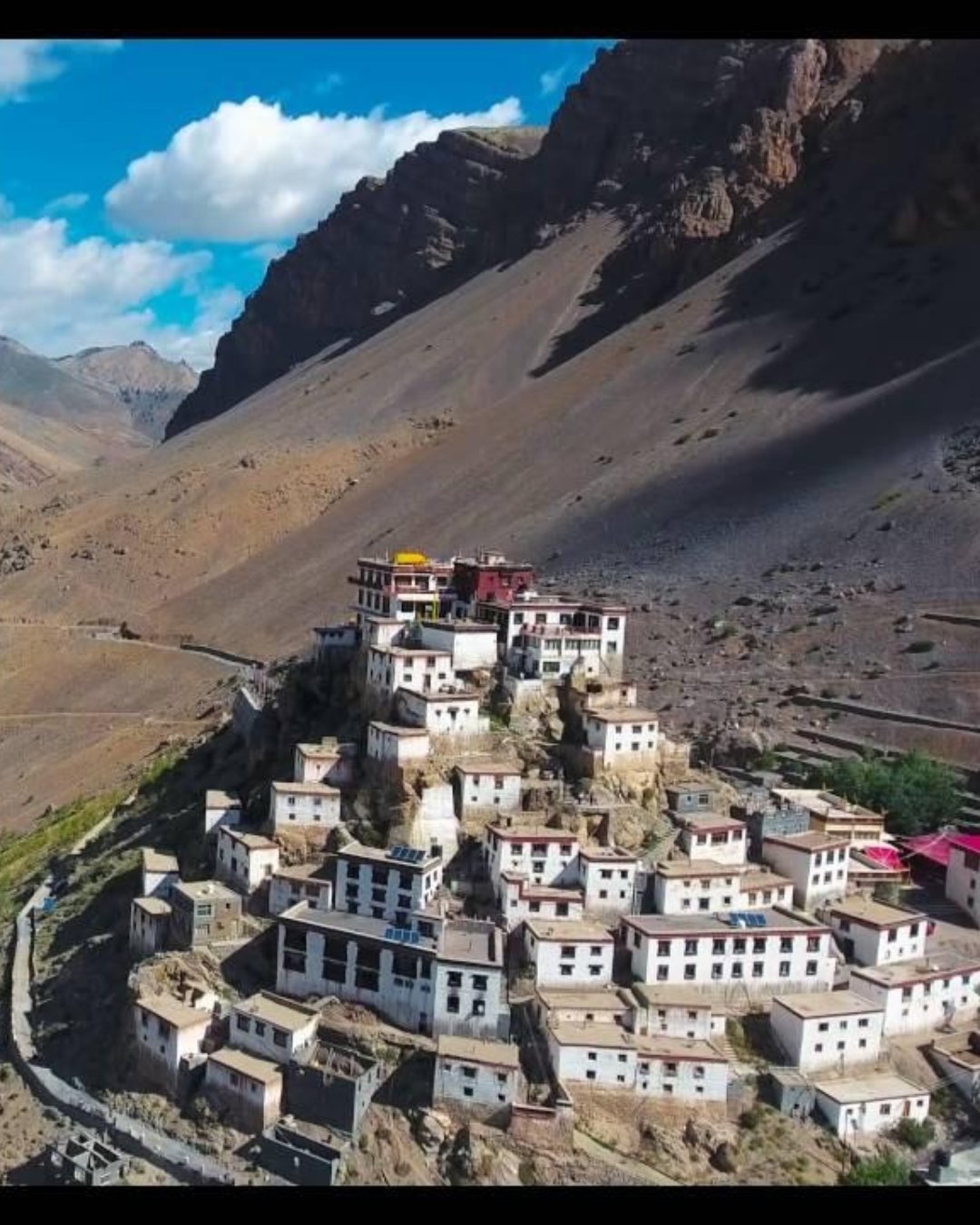
Sunset at Key Monastery
You've probably seen the shot. The white monastery stacked up its hill like something that grew there, the Spiti River curling below, the whole thing glowing against a wall of bare mountains. So you drive up mid-afternoon, walk around inside for half an hour, take the photo from the car park, and leave. And you miss it — because at two in the afternoon the light is flat and hard, the monastery is a grey lump, and the picture in your head refuses to appear.
Let's fix that. Here's how Key Monastery actually works, and how to get it right the first time.
Why the last hour, not the middle of the day
Key sits on a conical hill at around 4,100 m, facing roughly down the valley. In the flat overhead light of midday the mud-and-stone walls read as one dull mass, and the mountains behind go hazy and shapeless. It's the most photographed building in Spiti and it looks its worst at the hour most people show up.
Then the sun drops toward the ridgeline. The walls turn warm, then gold. The hill throws a long shadow, the tiers of the monastery separate out, and the peaks behind sharpen as the haze settles. That's the Key everyone means. It happens in the hour before sunset — so you want to be down the valley, looking back up at it, by around five.
What you'll actually see
Do the inside earlier in the day, then position for the light:
The classic view — from the road below and slightly down-valley, where the monastery stacks up against the mountains. This is the frame.
The prayer hall and kitchens — inside, older than the fort-like exterior suggests. Best visited late morning.
The monks — Key is a working Gelugpa monastery and teaching centre; young monks live and study here.
Kibber and the Chicham Bridge — a short drive higher, worth pairing if you have the afternoon.
Take a proper layer. Once the sun is off the hill the temperature drops hard at this altitude, and you'll be standing still with a camera.
And put the phone down when the light first turns gold. Travellers who've stood here will tell you the same thing: the urge is to fire off fifty frames the second it glows, and you end up with fifty near-identical shots and no memory of the place. Watch it first. The gold climbing the walls, the valley going blue below, the utter silence of it broken only by a dog or a distant bell — that's the part the photos never quite catch.
Pro tip: Sleep low, shoot high. Key is an easy morning-and-evening trip from Kaza (about 12 km), so base in Kaza rather than trying to stay up here, and come out for the light. If you do want the full experience, Key runs a simple guesthouse for pilgrims — basic, cold, and unforgettable, with the monks' morning prayers at dawn. Either way, dress modestly and move quietly inside; this is a place of worship, not a viewpoint with a temple attached.
The mistakes that ruin it
Most first-timers trip over the same few things. They come at midday, shoot the grey version, and wonder what the fuss is about. They photograph the inside and skip the down-valley view that's the actual icon. Or they arrive at 6:55 for a 7:00 sunset and miss the whole hour that mattered.
The easy fix is to base in Kaza, do the interior late morning, and be down the valley with the monastery lit by five — or let the day be planned around the light rather than the map.
Ready to see it for yourself?
Key at sunset is the moment most travellers came to Spiti for. Get the hour and the angle right, and it's effortless.
Want it handled end to end — the right base, the right timing, the monastery lit when you arrive? Browse our Spiti Valley Tour Packages, where Key comes built in, along with Kaza, the high villages, Kunzum Pass and Chandratal. Pick your dates and we'll take care of the light.
23
MomentLangza

Langza – The Fossil Village
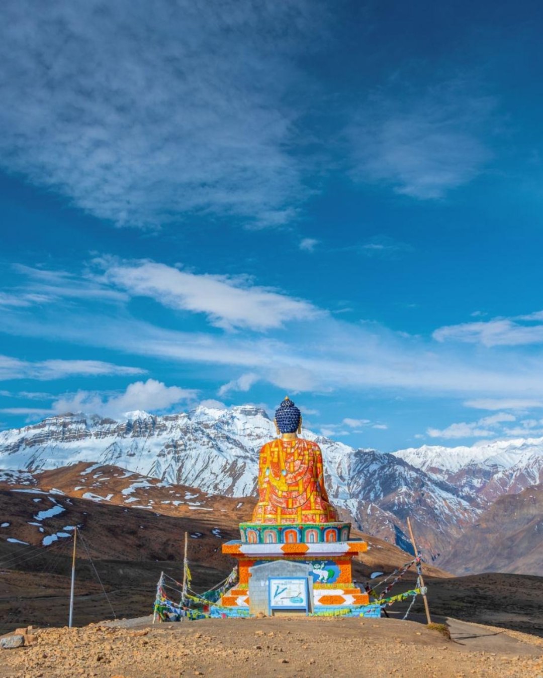
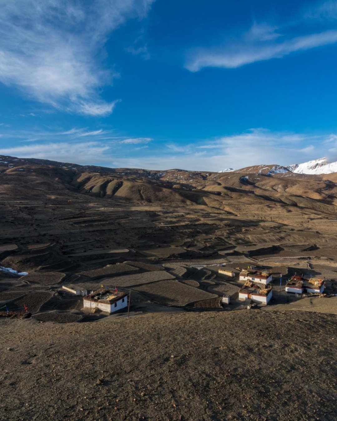
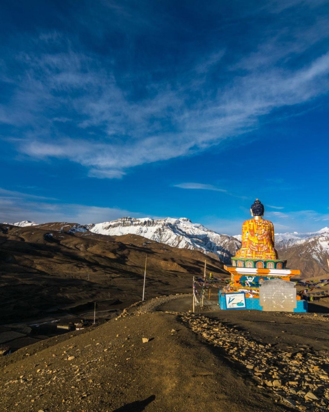
You've probably seen the giant Buddha. Sitting cross-legged above a scatter of stone houses, facing down an impossibly wide valley, the whole thing ringed by peaks. So you drive up, take the photo, buy a fossil from a kid at the roadside, and leave twenty minutes later. But here's the thing nobody tells you: that fossil may have been trucked in, the hills you didn't walk are full of real ones, and at 4,400 m that "quick stop" is exactly how people give themselves a pounding altitude headache for the rest of the day.
Let's fix that. Here's how Langza actually works, and how to get it right the first time.
Why you go slow, and go early
Langza sits at around 4,400 m — higher than almost anywhere you've slept. The mistake isn't visiting; it's treating it like a photo stop and moving fast. Walk uphill too quickly here and you'll feel it in your temples within the hour. Move slowly, breathe, and give it time.
Time also changes the place. Come in the flat middle of the day and it's a village with a statue. Come in early light or late afternoon and the low sun sets the Buddha and the whole valley glowing, with Chau Chau Kang Nilda — the big peak — catching the last of it. So take Langza first on the high-village loop, before the day heats and hazes over.
What you'll actually see
Langza is two things at once — a living farming village and a fossil bed from an ancient ocean:
The Buddha statue — a large seated Buddha above the village, facing the valley. The icon, and best at either end of the day.
The fossils — this whole area was under the Tethys Sea; ammonites and marine shells are embedded in the rock all around.
The old village and gompa — the stone houses and a small, very old temple above them.
The dairy — Langza is known for its milk, curd and chhurpi cheese; a fresh cup of curd here is the real souvenir.
Take a proper layer even at midday. The wind comes across this open plateau hard, and it's cold in shadow the moment the sun dips.
And put the phone down for the first few minutes when you arrive. Travellers who've stood up here will tell you the same thing: the instinct is to shoot the Buddha immediately, but the scale of the place doesn't fit a frame anyway. Stand still first. The silence, the sheer width of the valley, the thin bright air at 4,400 m — that's the part the photos never quite catch.
Pro tip: If you want to find a fossil, walk the hillsides above the village slowly and look — don't buy one at the road. And think hard before buying at all: these beds are being stripped, locals increasingly discourage it, and taking fossils out of India can technically breach heritage law. The better souvenir is a photograph and a cup of Langza curd. Hire a village kid as a fossil-spotting guide instead — it puts money where it belongs and they know exactly where to look.
The mistakes that ruin it
Most first-timers trip over the same few things. They race up, shoot the Buddha, and rush off with a headache. They buy a roadside "fossil" of unknown origin instead of finding a real one. Or they come at midday and get the flat, hazy, forgettable version of a genuinely spectacular place.
The easy fix is to come early, move slowly, and let Langza be a proper hour rather than a drive-by — or have the high-village day paced so nobody's rushing at altitude.
Ready to see it for yourself?
Langza is the moment most travellers remember from the high villages. Get the timing and the pace right, and it's effortless.
Want it handled end to end — the right hour, an unhurried loop, someone who knows the fossil ethics and the light? Browse our Spiti Valley Tour Packages, where Langza comes built in, along with Key Monastery, Hikkim, Komic, Kunzum Pass and Chandratal. Pick your dates and we'll take care of the altitude.
22
MomentHikkim Post Office [The World's Highest Post Office], Hikkim

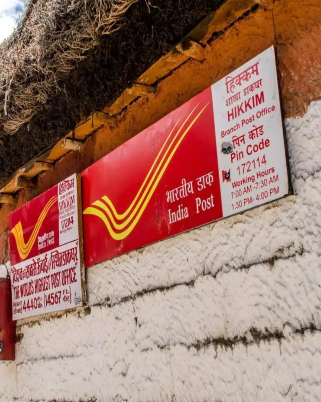
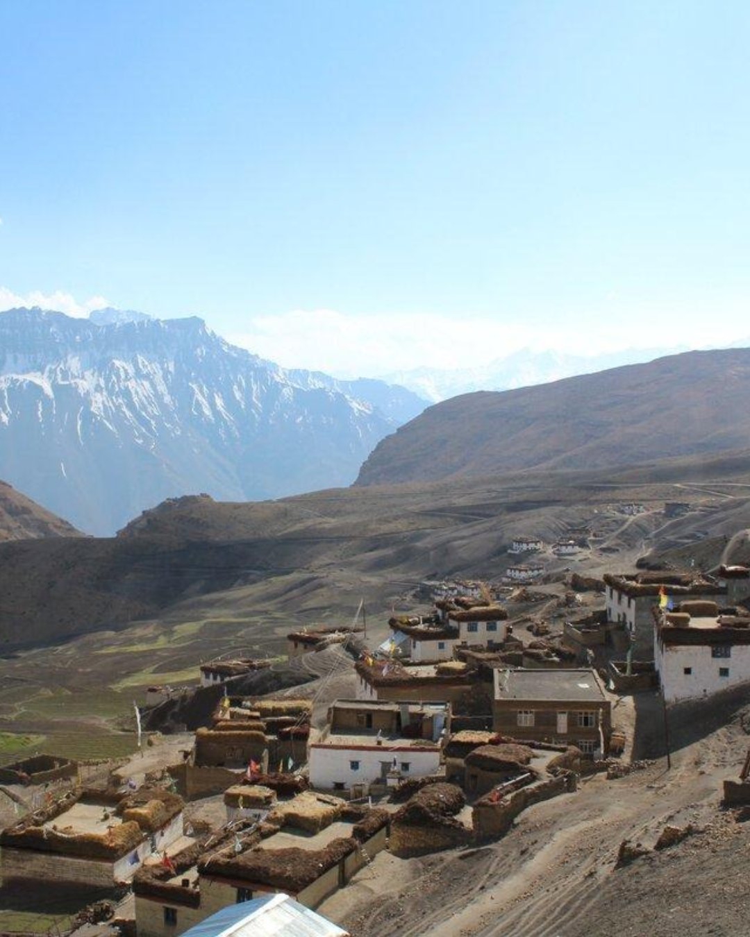
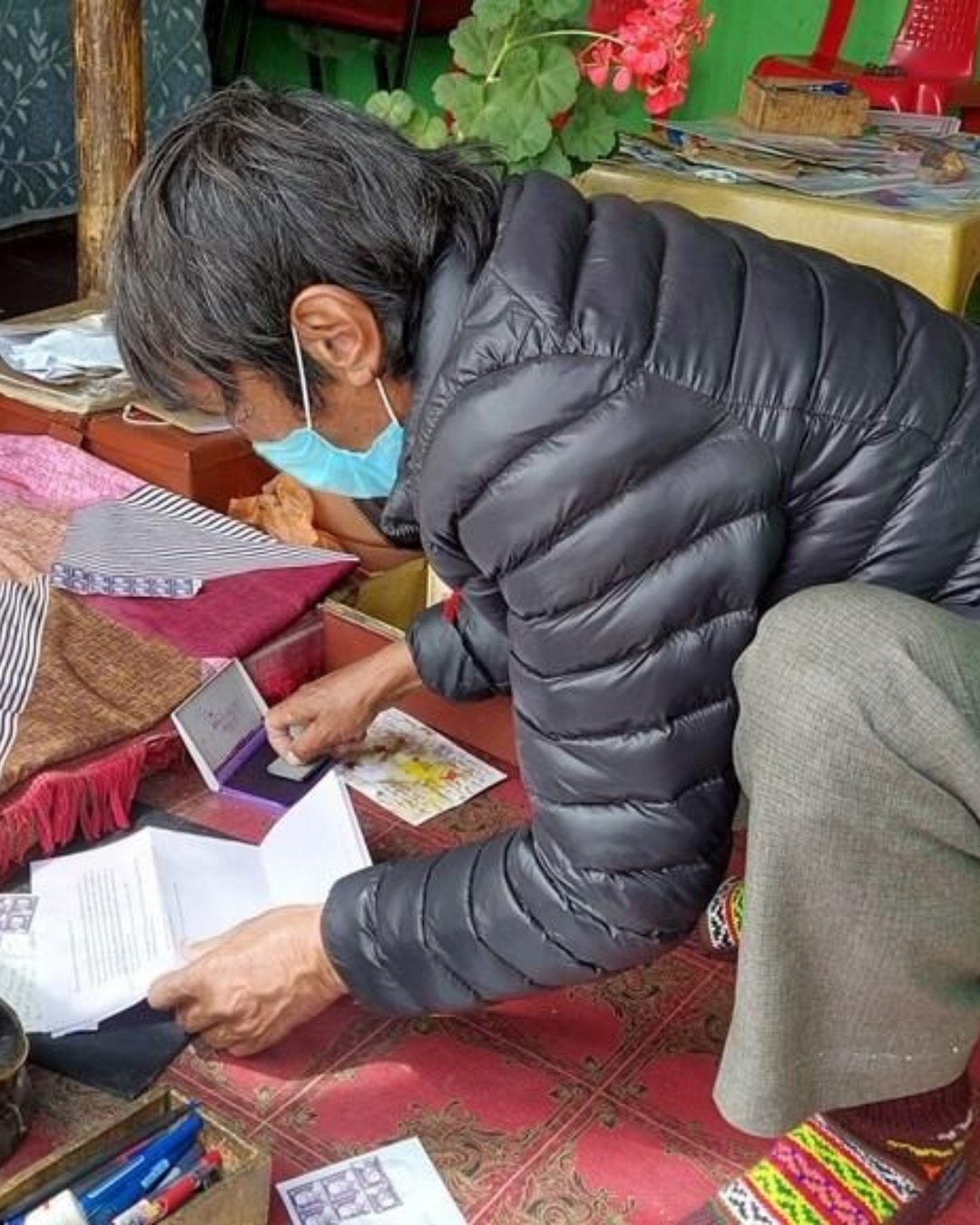
Hikkim – World's Highest Post Office
You've probably added this to the list as a novelty. Highest post office in the world, quick photo by the sign, back in the car. But here's the thing nobody tells you: turn up with nothing to send and you've driven to 4,400 m to look at a small stone building. No postcard, no pen, no cash, and the one thing that makes Hikkim worth the climb — a letter home, franked from the roof of the world — just doesn't happen. Worse, some days the postmaster isn't there and the shutter's down.
Let's fix that. Here's how Hikkim actually works, and how to get it right the first time.
Why it's about what you bring, not when you arrive
Hikkim's post office has run since 1983 at around 4,400 m, and the whole point of it is participation, not spectacle. It's a tiny room. There's no view to time, no light to chase. What there is, is a functioning counter where you can post a card that arrives at your door weeks later stamped from the roof of the world — and you can only do that if you came prepared.
So the trip is decided before you leave Kaza. Bring postcards, a pen, the addresses you want to send to, and small-denomination cash. Do that, and Hikkim is one of the loveliest half-hours of the trip. Forget it, and it's a sign and a shrug.
What you'll actually do
The village sits between Langza and Komic on the high loop above Kaza. Here's the routine:
Write your cards on the spot — or better, the night before in Kaza, so you're not scribbling at altitude with cold hands.
Buy stamps and post at the counter — the postmaster, Rinchen Chhering, has run it for decades; a card costs very little.
Send one to yourself — the postmark is the souvenir, and it's a small thrill when it lands home a month later.
The village and gompa — a quiet wander while you're up here, and views back across the valley.
Take a layer and small notes — cards and stamps are cash-only, and there's no change for big notes at 4,400 m.
And this is a stop where the phone genuinely comes second. Travellers who've done it will tell you the same thing: everyone shoots the sign, nobody remembers it. What you remember is writing the card — picking who gets one, what to say, sealing it in a stone room on the side of a mountain and handing it over. A photo of a signboard was never going to hold that.
Pro tip: Delivery is slow and not guaranteed — weeks, sometimes months, occasionally not at all — so treat the card as a lovely gamble, not a courier. Send several to spread the odds, and post one to your own address so you've got a keeper. And check the counter's actually open before you build your day around it: it keeps village hours, closes on holidays, and the postmaster is one man. If getting there matters, ask ahead in Kaza.
The mistakes that ruin it
Most first-timers trip over the same few things. They arrive with nothing to send and just photograph the sign. They bring no cash and can't buy a stamp. Or they turn up on a day the office is shut and find they've driven to 4,400 m for a locked door.
The easy fix is to prep in Kaza — cards, pen, addresses, cash — and check the office is open, so the visit is the thing you came for rather than a photo of a building.
Ready to see it for yourself?
Hikkim is the moment most travellers underestimate and then love. Get the prep right, and it's effortless.
Want it handled end to end — cards and cash sorted, the counter open, the loop paced for altitude? Browse our Spiti Valley Tour Packages, where Hikkim comes built in, along with Key Monastery, Langza, Komic, Kunzum Pass and Chandratal. Pick your dates and we'll take care of the details.
32
MomentKOMIC World's Highest Village, Komic

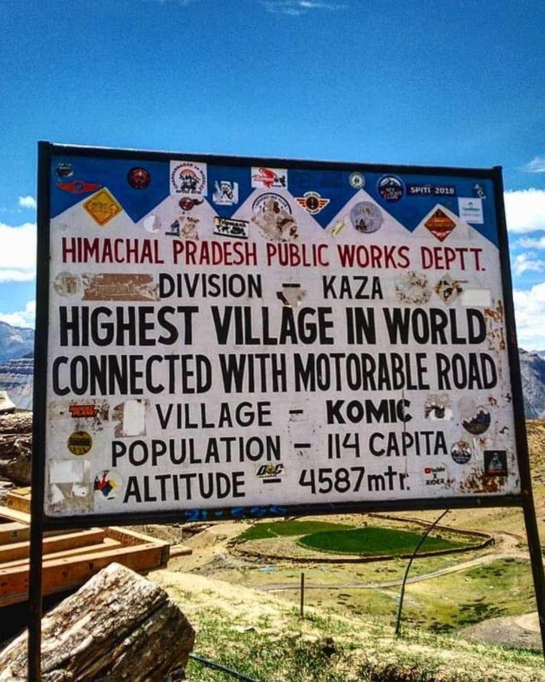
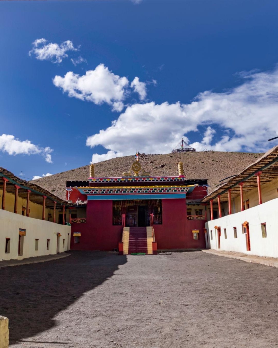
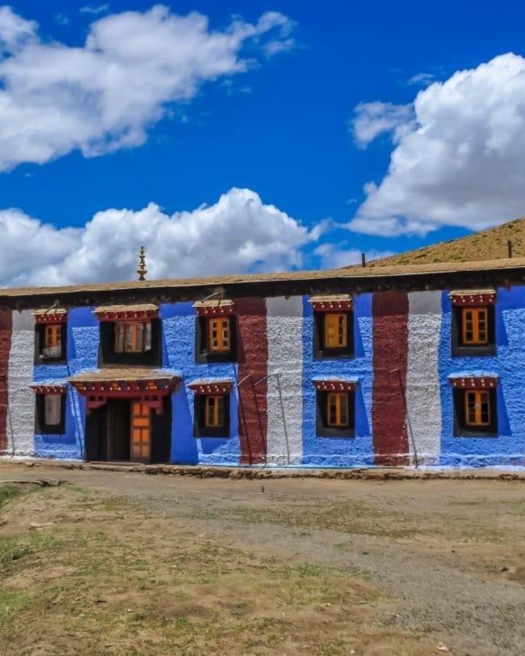
Komic – One of the World's Highest Villages
You've probably clocked this as a superlative to collect. One of the highest villages in the world with a motorable road, tick it off, photo by the sign. But here's the thing nobody tells you: Komic sits at roughly 4,590 m, and it's very likely the highest your body will go all day. If the altitude is going to catch anyone, it catches them here — and the people who arrive breathless and pounding are almost always the ones who raced up from Kaza without stopping to let their bodies keep up.
Let's fix that. Here's how Komic actually works, and how to get it right the first time.
Why the altitude, not the hour, is the thing to manage
Komic is the roof of the whole trip until Kunzum the next day — higher than Langza, higher than Hikkim, higher than where you slept. That's the entire challenge. There's no light to time and no crowd to beat; there's just thin air, and how well you've prepared your body to handle it.
So it comes at the end of the high-village loop, not the start — after you've spent the morning gaining height gradually through Key, Langza and Hikkim, not as a cold sprint from Kaza. Move slowly once you're out of the car. Don't march uphill. And be honest with yourself: if your head's pounding or you feel sick, this is the altitude talking, and the fix is to go down, not to push on for the photo.
What you'll actually see
A handful of houses, a monastery, and an enormous amount of sky:
Tangyud Monastery — one of the highest monasteries in the world, an old Sakya gompa with fortress-like mud walls, rebuilt after the 1975 earthquake.
The village — a few families farming green peas and barley at an altitude almost nothing grows at.
The wildlife — blue sheep and, in winter, the ghost of a chance at a snow leopard; red foxes are common.
The sign — yes, take the photo. Just make it the least interesting thing you did here.
Take a windproof layer whatever the season. There's nothing between Komic and the sky, and the wind at 4,590 m has an edge to it even in July.
And put the phone away for a few minutes when you arrive — partly for the usual reason, partly a practical one. Travellers who've been will tell you the same thing: the instinct is to rush around for photos, and rushing is exactly what you shouldn't do at this height. Stand still instead. The thinness of the air, the silence, the sense of being at the very top of the inhabited world — that's the part the photos never quite catch, and standing still is also how you let your body settle.
Pro tip: Do Komic last and briefest of the high villages. Fifteen or twenty unhurried minutes is plenty — long enough to see the monastery and feel the altitude, short enough that you're not lingering at the day's high point if you're not feeling it. Carry water and sip constantly; dehydration makes altitude worse and it creeps up fast in this dry air. And if anyone in the group goes quiet, headachy or nauseous, don't wait it out up here — dropping even to Kaza's height makes a real difference fast.
The mistakes that ruin it
Most first-timers trip over the same few things. They race up from Kaza and feel wrecked at the top. They linger too long at the highest point while a headache builds. Or they treat a real altitude symptom as something to push through for one more photo.
The easy fix is to reach Komic gradually, keep it short, and listen to your body — or have the loop paced by someone who watches the group for altitude rather than the clock.
Ready to see it for yourself?
Komic is the moment most travellers came to stand on top of. Get the pacing and the altitude right, and it's effortless.
Want it handled end to end — the loop paced properly, the group watched for altitude, nobody pushing past their limit for a sign? Browse our Spiti Valley Tour Packages, where Komic comes built in, along with Key Monastery, Langza, Hikkim, Kunzum Pass and Chandratal. Pick your dates and we'll take care of the height.
25
MomentKibber

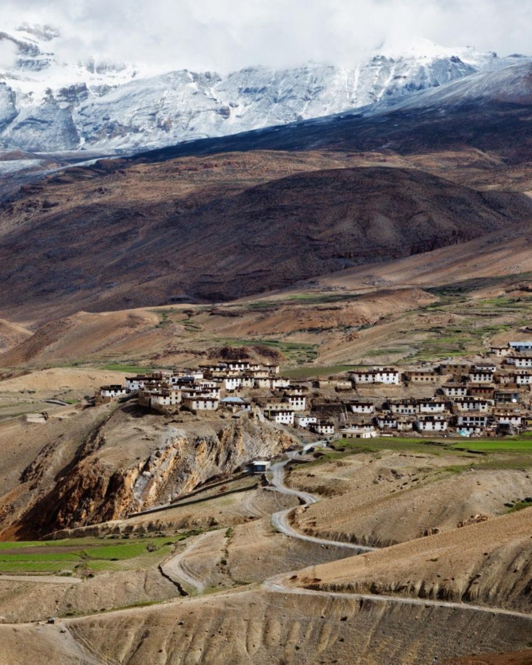
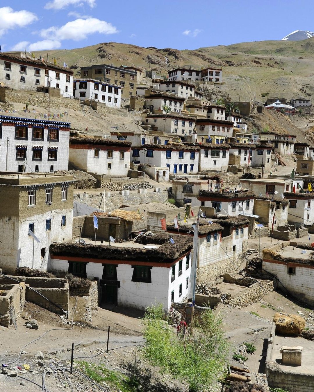
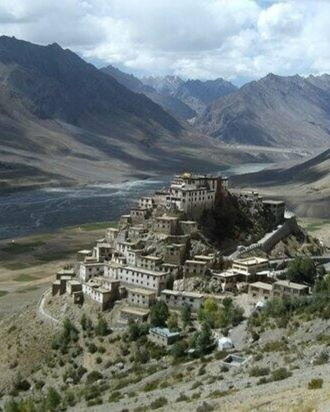
Kibber Village Experience
You've probably got Kibber down as a photo drive-through. Cross the famous Chicham bridge, snap the gorge, roll on to the next village. But here's the thing nobody tells you: Kibber is the one place on the whole loop worth staying in rather than passing through — it's the snow-leopard capital of the world, a working high-altitude village you can actually live inside for a night, and if you treat it as a fifteen-minute stop you'll drive right past the best homestay experience in Spiti.
Let's fix that. Here's how Kibber actually works, and how to get it right the first time.
Why you slow down, and ideally sleep here
Kibber sits at around 4,270 m, a cluster of whitewashed stone houses on a high shelf above the Spiti River, backed by the Kibber Wildlife Sanctuary. In summer it's a green pocket of barley and peas; in winter it becomes the single best base on earth for tracking snow leopards, which come down to hunt blue sheep on these slopes.
Most people give it twenty minutes. The village rewards far more — a night in a homestay, a slow walk out toward the sanctuary, a conversation with a family who've farmed at 4,270 m for generations. This is where Spiti stops being scenery you drive past and becomes a place you're briefly part of.
What you'll actually see
Chicham Bridge — the highest suspension bridge in Asia, strung across a deep gorge between Kibber and Chicham. It replaced a hand-hauled wire trolley locals crossed in for decades.
Kibber Wildlife Sanctuary — high-altitude cold desert, home to blue sheep, ibex, red fox, and the snow leopards that follow them.
The village itself — one of the highest with electricity and a motorable road, its old gompa, and homestays run by local families.
Tashigang and the high pastures — quiet walks out onto the plateau for anyone wanting more.
Take warm layers even in summer — nights at this height drop below freezing, and homestays are cosy but unheated beyond a bukhari stove.
And put the phone down once you're in the village, not just at the bridge. Travellers who've stayed here will tell you the same thing: the bridge is the photo, but the memory is the homestay — sitting in a low kitchen while the family cooks over the stove, butter tea in your hands, the temperature dropping outside. That, and the sheer silence of a village at 4,270 m after dark, is the part the photos never quite catch.
Pro tip: If your schedule can bend at all, spend a night in a Kibber homestay rather than basing only in Kaza — it's the most rewarding stay in Spiti and the money goes straight to the family. Cross the Chicham bridge on foot, not just by car, to feel the drop beneath it. And if snow leopards are the dream, that's a dedicated winter expedition (Jan–Feb), not a summer sighting — come in the right season with a proper spotter, or enjoy Kibber for the village it is the rest of the year.
The mistakes that ruin it
Most first-timers trip over the same few things. They shoot the bridge and leave, never seeing the village behind it. They expect snow leopards in summer, when the cats are high and unseen. Or they base only in Kaza and miss the one homestay night that would've been the highlight of the trip.
The easy fix is to build in time for Kibber rather than passing through — or let the loop be planned so a homestay night here is an option, not an afterthought.
Ready to see it for yourself?
Kibber is the moment most travellers drive past and later wish they'd stayed for. Get the time and the season right, and it's effortless.
Want it handled end to end — a homestay night, the bridge, the sanctuary, the right season for what you came for? Browse our Spiti Valley Tour Packages, where Kibber comes built in, along with Key Monastery, Langza, Hikkim, Komic and Chandratal. Pick your dates and we'll take care of the stay.
27
MomentChicham Bridge, Chicham Khas

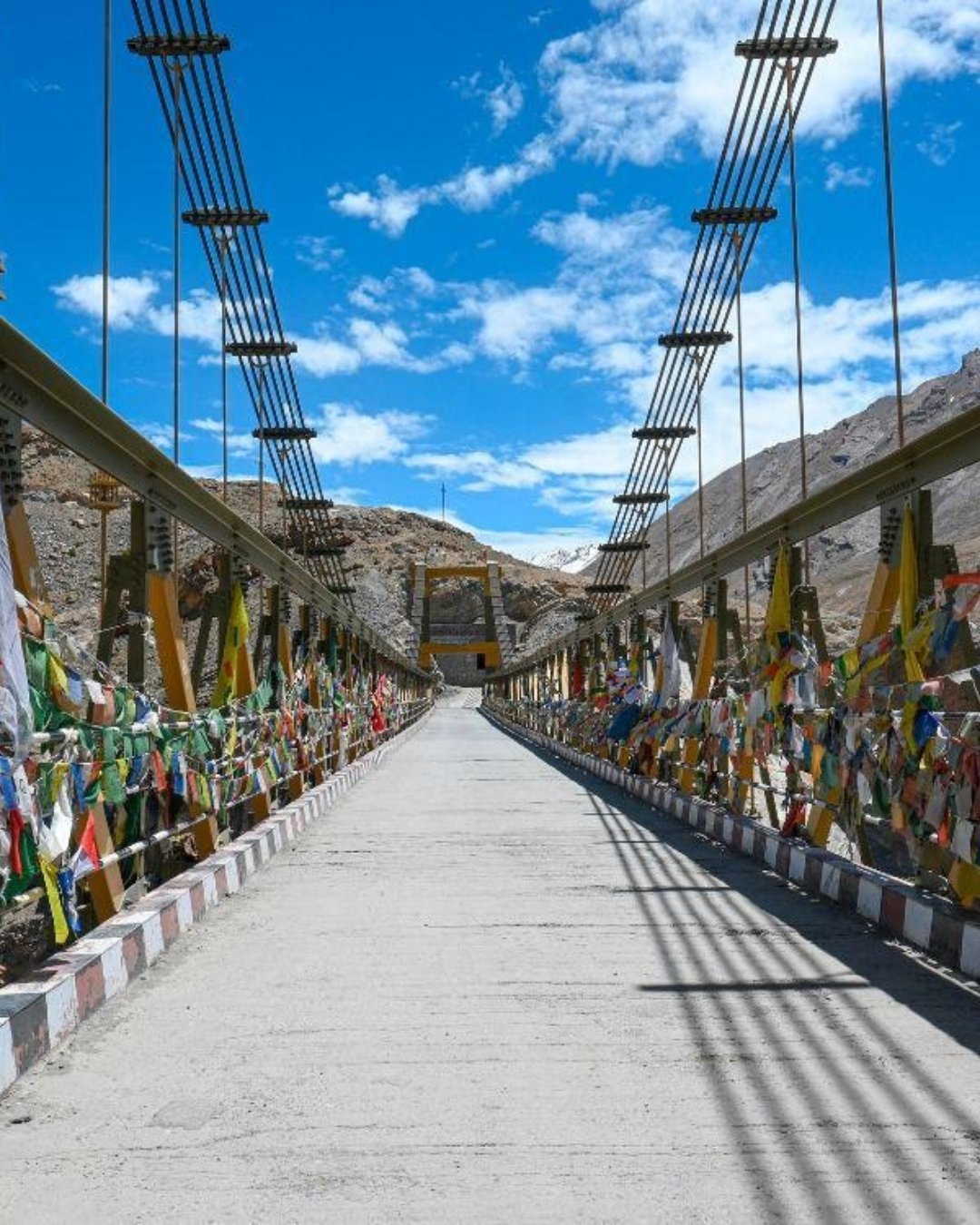
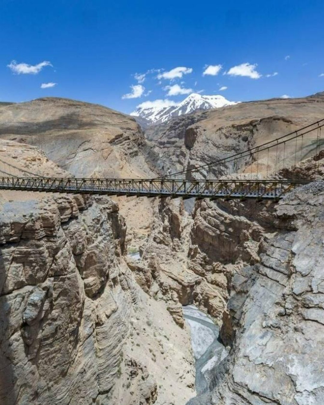

Chicham Bridge Adventure
You've probably seen it on a reel. A thin steel span strung across a huge gorge, someone standing mid-bridge with a thousand feet of nothing under them, the caption calling it the highest bridge in Asia. So you drive across it, film out the window, and you're over in ninety seconds. But here's the thing nobody tells you: crossing it in a car is the one way to feel almost nothing. The gorge, the height, the whole point of the place only lands when you're on foot in the middle of it — and most people never get out.
Let's fix that. Here's how Chicham Bridge actually works, and how to get it right the first time.
Why you stop and walk it, not drive it
Chicham links the villages of Kibber and Chicham across a deep gorge at around 4,145 m, and at roughly 120 m above the riverbed it's counted among the highest bridges in Asia. From inside a moving car it's just a road. On foot, it's a different thing entirely — the deck moves a little, the wind funnels through the canyon, and the drop opens up on both sides.
There's no light to time here and no crowd to beat at altitude; the whole experience is simply getting out and standing on it. Park at one end, walk to the middle, look down, and let it register. That's the adventure the reels are selling, and it takes five minutes most people skip.
What you'll actually see
The gorge — the Samba Lamba (Parilungbi) ravine dropping away beneath the deck, sheer on both sides.
The span itself — a single steel suspension bridge, opened in 2017 after roughly two decades of construction.
Kibber and Chicham — the two high villages it joins, each worth a stop in its own right.
The old crossing — before the bridge, locals crossed the gorge in a hand-hauled iron trolley on a wire, a terrifying business that the bridge finally ended.
Take a windproof layer. The canyon channels the wind, and standing still on an exposed steel deck at 4,145 m gets cold fast even on a bright day.
And here's the one place the phone earns its keep rather than getting in the way — but keep a firm grip on it. Travellers who've stood on it will tell you the same thing: yes, this is the shot, film away. Just don't be the person who drops a phone into a 120-metre gorge reaching for the perfect angle, and don't lean on the cables for it. Get the footage, then put it away and actually look down. The scale of the drop, the wind, the sheer improbability of a bridge here at all — that's the part the reel never quite carries.
Pro tip: Walk across and back rather than driving — it's the only way to feel it, and it costs you ten minutes. Pair it with Kibber, which sits right beside it, so the bridge is part of a proper village stop rather than a solo photo mission. Watch for traffic on the deck: it's a single lane and vehicles do cross, so keep to the side. And go easy on the exertion — it's tempting to jog across for a video, but you're at 4,145 m and even a short sprint will leave you gasping.
The mistakes that ruin it
Most first-timers trip over the same few things. They drive across without stopping and feel nothing. They sprint about for photos and get winded at altitude. Or they treat it as a standalone detour and skip Kibber right next to it.
The easy fix is to stop, walk it, and fold it into the Kibber visit — or let the loop be paced so the bridge is a proper stop, not a blur through the windscreen.
Ready to see it for yourself?
Chicham is the moment most travellers film and then wish they'd actually stood on. Get the stop and the pace right, and it's effortless.
Want it handled end to end — the bridge on foot, Kibber alongside it, the day paced for altitude? Browse our Spiti Valley Tour Packages, where Chicham comes built in, along with Key Monastery, Langza, Hikkim, Komic and Chandratal. Pick your dates and we'll take care of the crossing.
42
MomentLosar

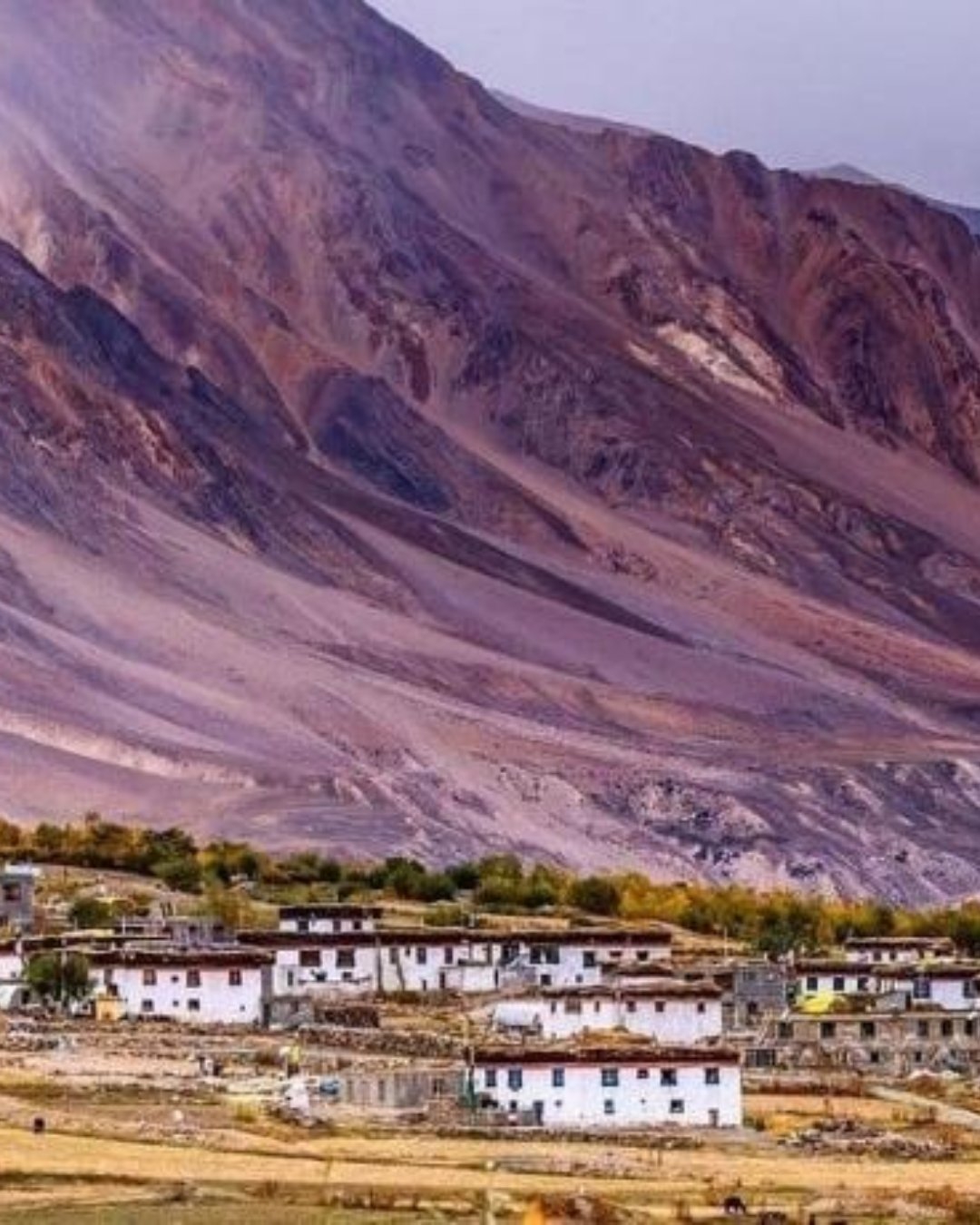
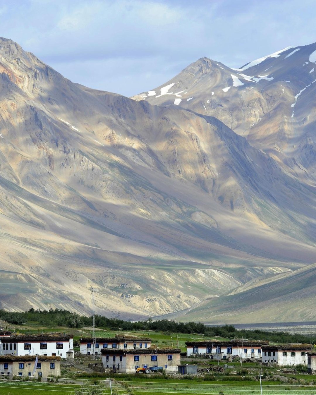
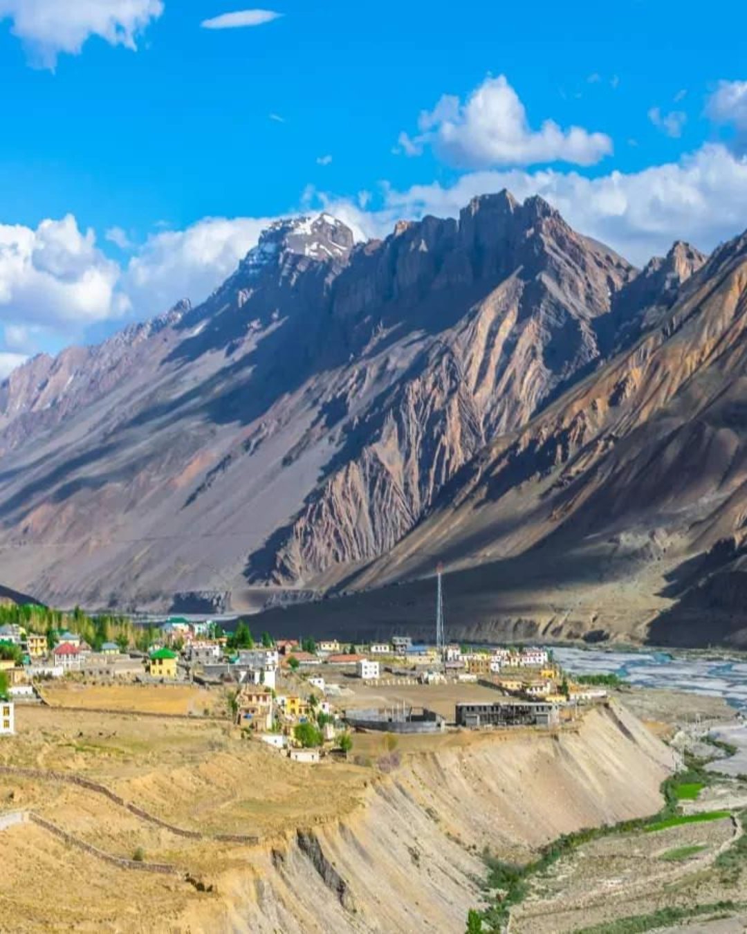
Losar – The Last Village of Spiti
You've probably got Losar down as a place you pass through. The last village before Kunzum, a checkpost, maybe a tea stop, then on to Chandratal. But here's the thing nobody tells you: Losar is a hard gate, not a waypoint. The checkpost here has fixed hours and a firm cut-off, Kunzum Pass beyond it closes with the weather, and travellers who roll up late — or in the wrong month — find the barrier down and the road to Chandratal simply shut for the day, or the season.
Let's fix that. Here's how Losar actually works, and how to get it right the first time.
Why the timing here isn't about light — it's about the gate
Losar sits at around 4,080 m, the last inhabited village on the Spiti side before Kunzum Pass. It's a genuine frontier: past here there's no fuel, no reliable network, no settlement until you're over the pass and down toward Batal. The checkpost registers everyone through, and it keeps hours — arrive after the cut-off and you don't cross that day.
And the pass itself is seasonal. Kunzum, just beyond Losar, is only open roughly mid-June to mid-October; snow closes it early and late, and even in season a bad morning can shut it. So Losar is where the trip's whole "can we get to Chandratal and Manali" question gets answered — which means you leave Kaza early, not at a leisurely hour, to reach the gate with time in hand.
What you'll actually see
The checkpost — where you register out of Spiti. Have your ID and permits ready.
The village and gompa — traditional Spitian houses and a small monastery, among the last you'll see.
The Losar-to-Kunzum climb — the road beyond, switchbacking up to the 4,590 m pass and its prayer-flag chorten.
The tea houses — a hot thukpa or chai here is the last proper food before Batal, hours away.
Take everything warm you have within reach. Losar catches the wind funnelling off Kunzum, and it's cold and exposed even when Kaza was mild.
And this is one of the last spots you'll have any signal at all, so use it like you used Kaza. Travellers who've done this crossing will tell you the same thing: send your "we're going offline over the pass" message here, because past Losar you vanish for the rest of the day. Then put the phone away and take it in — the sense of standing at the edge of the inhabited valley, the road climbing into nothing ahead, the quiet of the last village. That's the part the photos never quite catch.
Pro tip: Leave Kaza early on the Chandratal day — treat Losar's checkpost and Kunzum's weather window as the real constraints, not your breakfast. Fuel to full back in Kaza, because there's nothing past here. Eat a proper meal at Losar, since the next dependable food is the Batal dhaba hours away over the pass. And check the pass status the evening before: if Kunzum's shut, Losar is where you'd otherwise waste half a day finding out.
The mistakes that ruin it
Most first-timers trip over the same few things. They leave Kaza late and reach the checkpost after cut-off. They come at the season's edge and find Kunzum closed. Or they treat Losar as a quick stop and roll on hungry, low on fuel, into a stretch with neither.
The easy fix is to reach Losar early, fuelled, fed and checked — or let the crossing day be planned around the gate and the pass rather than the clock on the wall.
Ready to see it for yourself?
Losar is the moment most travellers pass without noticing — until it's the thing standing between them and Chandratal. Get the timing and the fuel right, and it's effortless.
Want it handled end to end — an early start, the checkpost cleared, the pass status known, fuel and food sorted? Browse our Spiti Valley Tour Packages, where the crossing comes built in, along with Kaza, the high villages, Kunzum Pass and Chandratal. Pick your dates and we'll take care of the gate.
26
MomentKunzum Pass, Dhar Thachakarpo

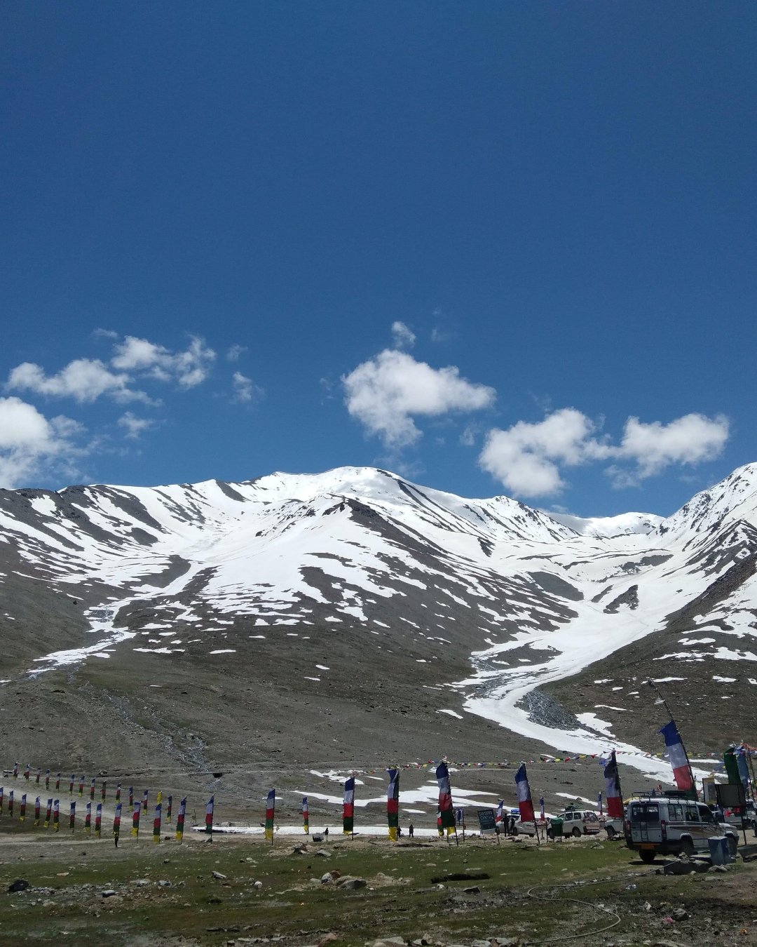
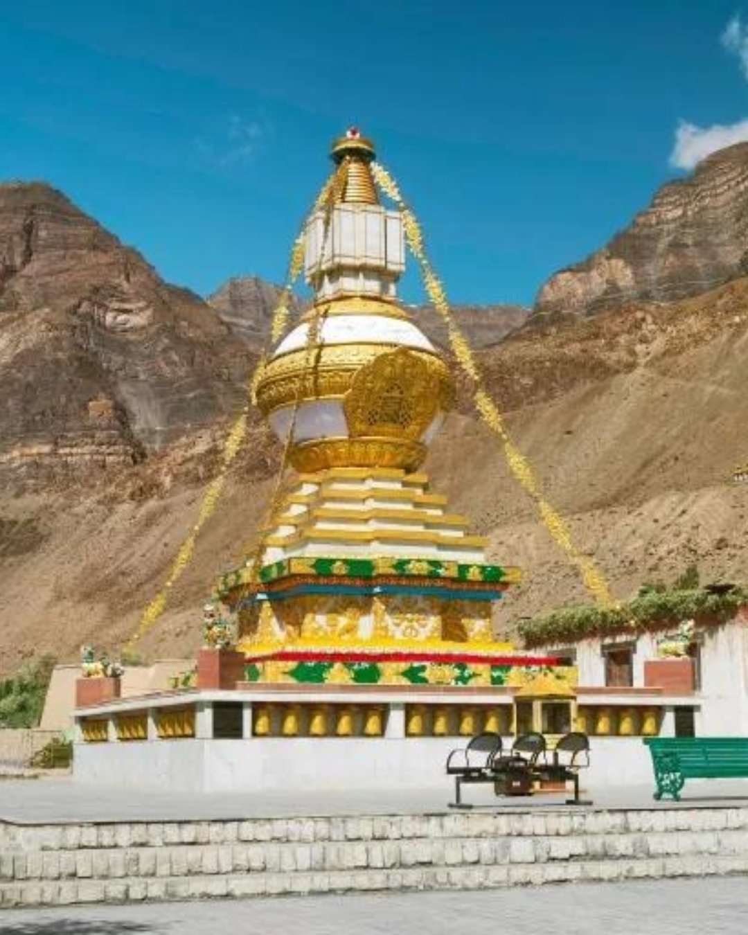
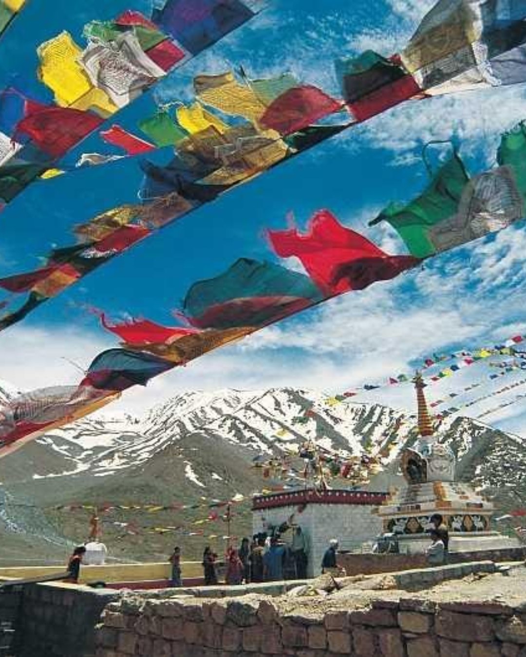
Kunzum Pass
You've probably seen it framed as just a high point on the drive. A pass, a sign, some prayer flags, a photo before you carry on to Chandratal. But here's the thing nobody tells you: Kunzum is the hinge the whole trip turns on. It's shut for more than half the year, it can close on any given morning with a single bad weather turn, and the chorten at the top isn't a photo prop — it's a ritual that drivers here take seriously, and rolling past it without stopping is the one thing you don't do.
Let's fix that. Here's how Kunzum Pass actually works, and how to get it right the first time.
Why the season and the morning decide everything
Kunzum sits at 4,590 m, linking Spiti to Lahaul, and it's only open roughly mid-June to mid-October. Snow closes it early and late, and even in season it's a morning game — cross early, while the weather holds and the streams beyond it are low, because afternoon brings cloud, wind and rising meltwater on the Batal side.
So this isn't a stop you drift up to at midday. You leave Kaza early, clear Losar's checkpost, and take the pass with the day in front of you. The pass is what makes the whole Shimla-to-Manali circuit possible; it's also the first thing to shut it down. Treat it as the appointment the rest of the day is built around.
What you'll actually see
The top is a wide, wind-scoured saddle with big views and a working shrine:
* The Kunzum Mata temple and chorten — wrapped in prayer flags, dedicated to the pass goddess who's believed to grant safe passage.
* The parikrama — drivers make a slow clockwise circle of the chorten in their vehicle before crossing. Let yours do it.
* The CB Ranges and the Bara Shigri Glacier view — one of the longest glaciers in the Himalaya, visible in the distance.
* The Chandratal turnoff — the rough side track to the lake branches off just beyond the pass.
Take everything warm you own. At 4,590 m the wind has a real bite even in July, and you'll want to be out of the vehicle for a few minutes at the top.
And put the phone down after the first photo. Travellers who've crossed here will tell you the same thing: the flags and the sign are the easy shot, but the pass is bigger than a frame. Stand in the wind for a minute. The prayer flags snapping, the ranges stacked to the horizon, the thin cold air at the very top of the crossing — and the quiet satisfaction of making it over — that's the part the photos never quite catch.
Pro tip: Join the parikrama — let your driver make the clockwise circle of the chorten, and don't rush them; it's a custom worth respecting, not a delay. Cross early in the day for better weather and lower stream crossings on the Batal side. Check the pass status the evening before from Kaza. If Kunzum is expected to close, it's far better to know before leaving than after driving all the way to Losar.
The mistakes that ruin it
Most first-time travellers make the same mistakes. They visit at the edge of the season and find the pass closed. They cross late in the day and encounter bad weather and swollen streams. Or they treat the chorten as just another backdrop and miss the local tradition that gives the pass its meaning.
The easy fix is simple: cross early, travel during the open season, and check road conditions before setting out — or let someone familiar with the route plan the crossing around the mountain rather than the clock.
Ready to see it for yourself?
Kunzum Pass is the moment most travellers photograph without realising it's the reason the entire Spiti circuit exists. Get the season and the timing right, and the crossing feels effortless.
Want it handled end to end — the right season, an early crossing, current pass conditions, and a perfectly timed journey onward to Chandratal? Browse our Spiti Valley Tour Packages, where Kunzum Pass comes built in, along with Kaza, the high villages, Losar and Chandratal. Pick your dates and we'll take care of the mountain.
14
MomentChandra Taal, Dhar Makpachhe

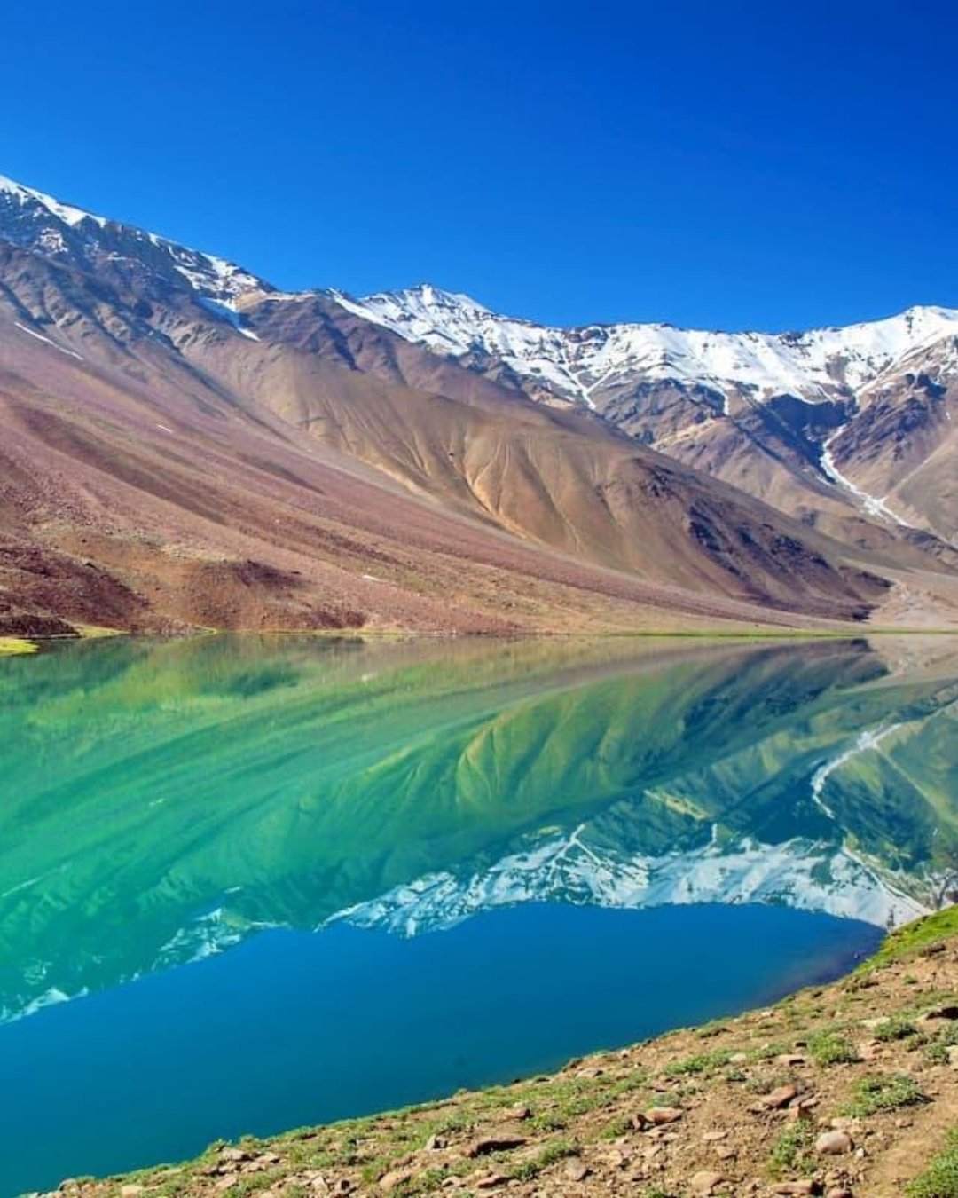
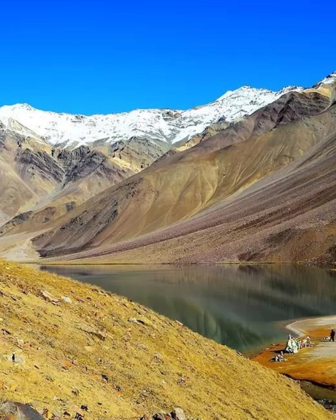
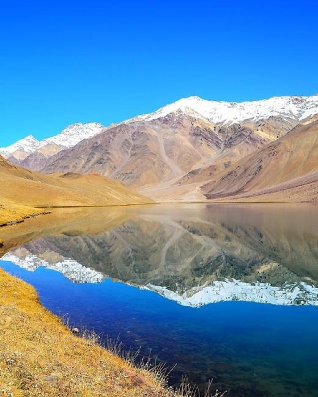
Chandratal Lake Adventure
You've probably seen the drone shot. A crescent of impossible blue-green water in a bowl of bare mountains, a couple of tents on the grass, the Milky Way overhead. So you picture pitching right by the water and falling asleep to the lapping. But here's the thing nobody tells you: you can't camp at the lake anymore, the "quick look" people plan turns into the highest and coldest night of the trip at 4,300 m, and the ones who treat it casually are the ones who don't sleep and feel wrecked in the morning.
Let's fix that. Here's how Chandratal actually works, and how to get it right the first time.
Why the altitude, not the view, is what you plan around
Chandratal sits at about 4,300 m, and it's very likely the highest you'll sleep on the whole trip. That single fact shapes everything. Camping on the lakeshore is now prohibited to protect the fragile ecosystem, so the seasonal camps are located 2–3 km away. You'll walk the final stretch to the lake instead of driving all the way to the shoreline. And spending a night at this altitude, especially after crossing Kunzum Pass, is where altitude sickness quietly catches people who treated the lake as a quick photo stop rather than a serious overnight stay.
It's also entirely seasonal. The road usually opens from mid-June to October, and the camps close once snowfall returns. This is a summer and early autumn experience, planned around both road conditions and your body's ability to sleep comfortably at high altitude.
What you'll actually see
The lake itself is the highlight, but it transforms completely depending on the time of day:
* The lakeside walk — a 20–30 minute walk from the camps to the shoreline, with the full circuit taking around an hour on foot.
* The changing colours — the water shifts from steel grey to turquoise and deep sapphire blue as the light changes. Late afternoon and early morning offer the most spectacular views.
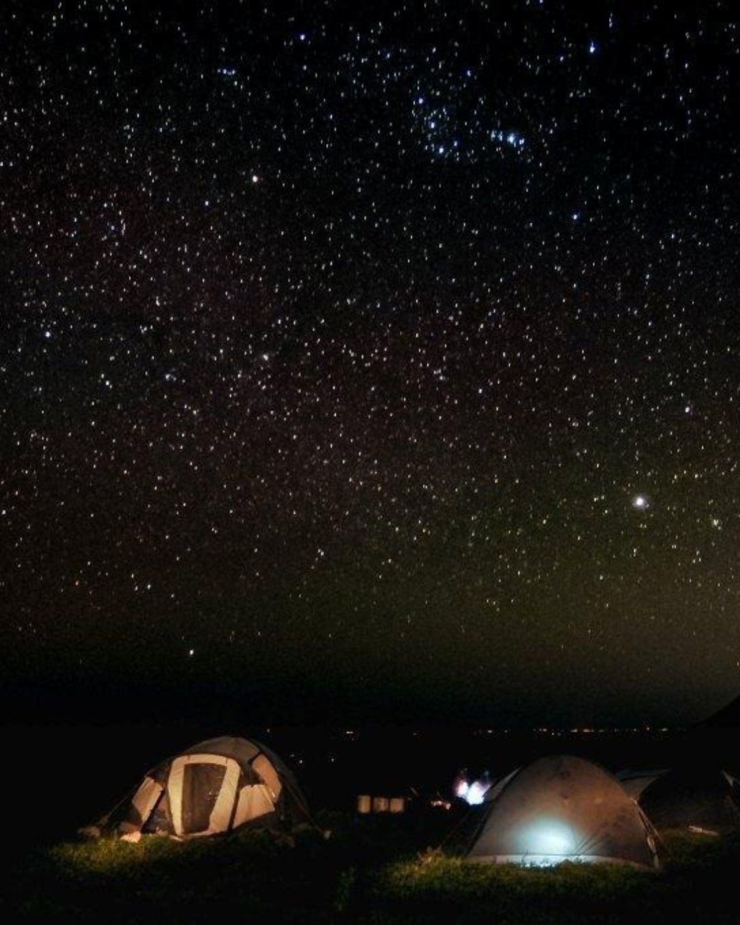
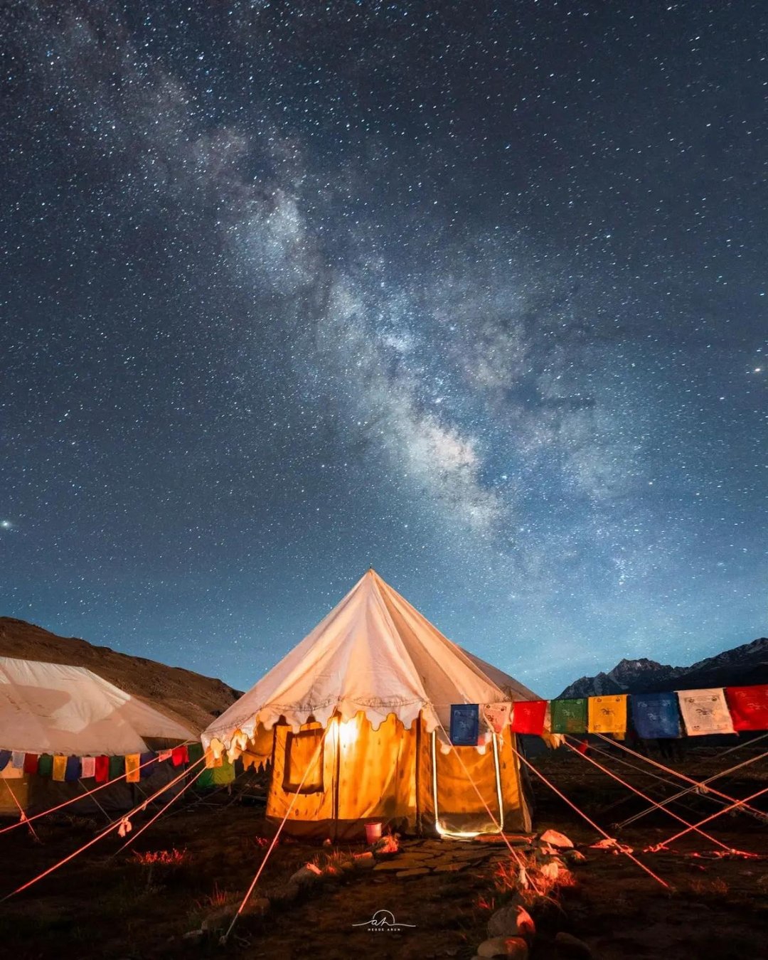
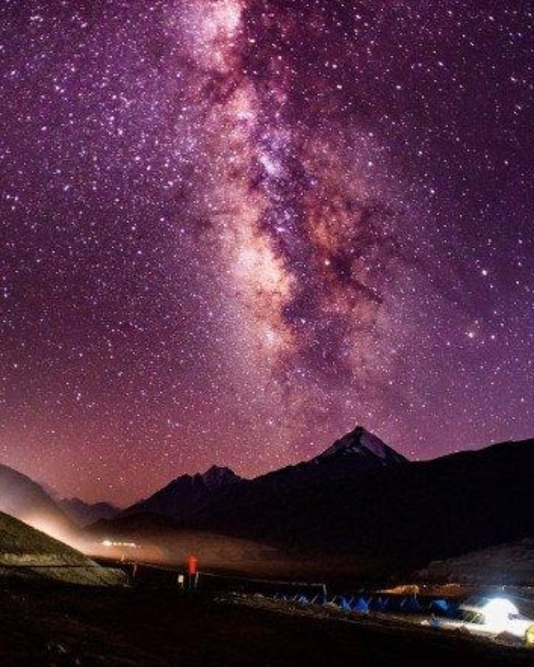
* The night sky — the real reason to stay overnight. At 4,300 m, with virtually no light pollution, the Milky Way stretches brilliantly across the sky.
* The camps — simple Swiss-tent camps on alpine meadows serving warm meals, chai, and basic mountain hospitality.
Bring every warm layer you own. Temperatures regularly fall below freezing even during July nights. The tents rely on thick blankets rather than heaters, and it's the combination of cold and altitude that makes the night difficult for anyone who arrives unprepared.
And once you've taken a few photographs, put the phone away—especially after dark. Travellers who've spent the night here often say the same thing: everyone tries to photograph the stars, but most pictures fail to capture what they're actually seeing. Lie back instead. The silence, the freezing mountain air, and a sky overflowing with stars above the dark outline of Chandratal are the moments no camera truly records.
Pro tip: Stay well hydrated throughout the afternoon and avoid unnecessary exertion. This is not the place to push yourself physically. If you've experienced any symptoms of altitude sickness during the day, mention them to your guide before committing to the overnight stay. Visit the lake during late afternoon or sunrise for the best light, carry a headlamp, warm sleepwear, and enough drinking water, and reserve your campsite well in advance during peak season—good camps fill quickly, and arriving without a booking can leave you with very limited options.
The mistakes that ruin it
Most first-time travellers make the same mistakes. They expect to camp beside the lake and discover the camps are set back. They underestimate the cold and spend a sleepless night. Or they treat the highest overnight stay of the journey too casually and let altitude sickness spoil the experience.
The easy fix is simple: prepare properly for the cold and the altitude, reserve your camp ahead of time, and plan the lakeside walk around the best light—or let someone experienced handle the logistics while you simply enjoy the experience.
Ready to see it for yourself?
Chandratal Lake is the moment most travellers dream about long before arriving in Spiti. Get the altitude, the warm layers, and the timing right, and it becomes unforgettable.
Want it handled end to end—a comfortable campsite, perfectly timed lake walks, careful altitude planning, and a seamless journey onward to Manali? Browse our Spiti Valley Tour Packages, where Chandratal comes built in alongside Kaza, the high villages, Kunzum Pass, and the spectacular drive through the Himalayas. Pick your dates and we'll take care of the mountains.
20
MomentCold Desert Camps, Dhar Pallamo

Stargazing at Chandratal
You've probably saved someone's Milky Way shot over the lake. A river of stars arching over the black bowl of mountains, the water catching a little of the light. So you figure you'll step out after dinner, look up, and there it'll be. But here's the thing nobody tells you: the sky you came for only shows on a moonless, cloudless night. Turn up during a full moon and its brightness washes the Milky Way away, and the people who wander outside at 9 p.m., glance up, and head back to their tents often miss the magical hours after midnight when the sky is at its finest.
Let's fix that. Here's how stargazing at Chandratal actually works, and how to get it right the first time.
Why the moon phase decides everything
At 4,300 metres, with no towns or artificial lights for miles, Chandratal offers some of the darkest skies you'll ever experience—but only if the moon cooperates. A bright moon acts like a giant floodlight, drowning out the faint band of the Milky Way. So the single biggest factor isn't your campsite or your camera—it's the lunar calendar. Around the new moon is ideal. During a full moon, even perfectly clear skies won't reveal nearly as many stars.
Timing matters too. The sky becomes darker and richer as the night progresses, with the Milky Way often looking its best well after midnight rather than immediately after dinner. If you're chasing unforgettable stars, plan to stay up late—or set an alarm—and be prepared for serious mountain cold.
What you'll actually see
On a clear, moonless night, Chandratal rewards you with one of the finest night skies in the Himalayas:
* The Milky Way core — a brilliant river of stars stretching overhead, especially spectacular during the summer months.
* Shooting stars — frequent under these dark skies, with the Perseid meteor shower in August being particularly impressive.
* Planets and satellites — bright planets like Jupiter and Saturn are easy to spot, while satellites silently glide overhead.
* Reflections on the lake — when the wind drops, Chandratal mirrors the stars, creating a breathtaking double image.
Wear every warm layer you have, then add another. Standing still outside after midnight at 4,300 metres is dramatically colder than walking around during the day. It's the cold—not the altitude—that sends most people back to their tents before the best part of the night arrives.
And here's the honest truth about photography: once you've taken a few pictures, put the phone away. Travellers who've experienced Chandratal often say the same thing. Hours disappear while trying to capture a disappointing photo, while the real spectacle unfolds overhead. Unless you're carrying a proper camera, tripod, and know how to shoot the night sky, simply lie back and watch. The depth of the stars, the silence of the mountains, and the icy air around the lake are experiences no phone camera can truly capture.
Pro tip: If stargazing is one of the main reasons for visiting Chandratal, plan your trip around the new moon rather than leaving it to chance. Give your eyes at least twenty minutes to adjust to the darkness, avoid using bright white lights, and switch your headlamp to red mode if possible to preserve your night vision. Bring a sleeping mat or blanket, a flask of something warm, and if you're planning astrophotography, scout your composition before sunset. Most importantly, don't sacrifice all your sleep—you'll still have a challenging mountain drive ahead the next morning.
The mistakes that ruin it
Most first-time travellers make the same mistakes. They visit during a full moon and wonder where the Milky Way went. They step outside too early, feel cold within minutes, and return to the tent before the sky reaches its peak. Or they spend the entire evening struggling with a phone camera instead of simply enjoying one of the darkest skies in India.
The easy fix is simple: choose a dark-sky night, dress for freezing temperatures after midnight, and decide before you arrive whether you're there to photograph the stars or simply experience them—or let your itinerary be planned around the moon rather than leaving it to luck.
Ready to see it for yourself?
The night sky above Chandratal is the memory many travellers carry home long after the journey ends. Get the moon phase, the timing, and the warm layers right, and it becomes an unforgettable experience.
Want it handled end to end—a campsite reserved under dark skies, perfectly timed dates, and everything planned for a comfortable night beneath the stars? Browse our Spiti Valley Tour Packages, where a Chandratal overnight stay comes built in alongside Kaza, the high villages, Kunzum Pass, and the unforgettable drive to Manali. Pick your dates and we'll take care of the sky.
24
MomentAtal Tunnel, Burwa

Through the Atal Tunnel
You've probably filed this under "the boring bit." A tunnel at the end of the trip, the drive home to Manali, nothing to see. But here's the thing nobody tells you: the hours before the tunnel are the wildest driving of the whole journey—Batal, the stream crossings, the long descent from Kunzum Pass—and how you time them decides whether the Atal Tunnel becomes a smooth finale or the point where swollen glacier-fed streams leave you stranded for hours.
Let's fix that. Here's how the drive through the Atal Tunnel actually works, and how to get it right the first time.
Why the morning matters more than the tunnel
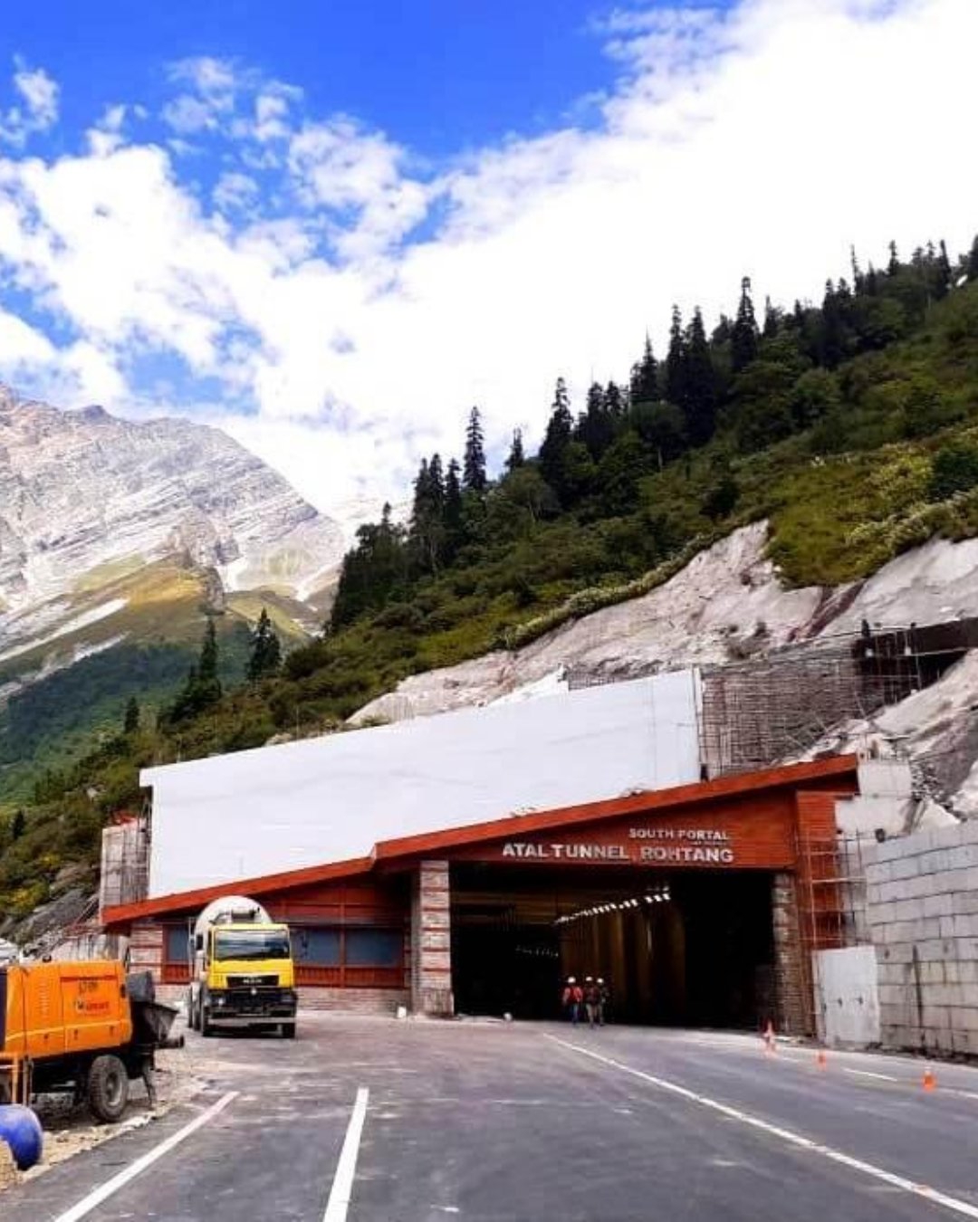
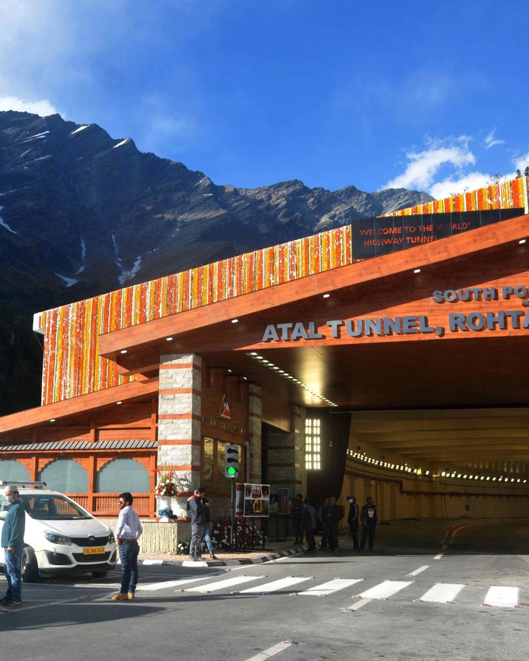
The tunnel itself is the easy part. Stretching 9.02 km beneath the Rohtang massif at around 3,000 metres, the Atal Tunnel opened in 2020 and transformed what was once a difficult four-to-five-hour drive over Rohtang Pass into a journey of just ten minutes. It's open throughout the year and makes travel between Lahaul and Manali possible even when Rohtang remains snowbound.
The real challenge comes before you reach it.
Leaving Chandratal, you'll descend through Batal before crossing the famous Chhota Dhara and Pagal Nala—glacier-fed streams without permanent bridges. Early in the morning the water levels are usually manageable, but by afternoon snowmelt can turn them into powerful crossings that delay traffic for hours or even make them temporarily impassable.
That's why you leave Chandratal early. The tunnel doesn't care what time you arrive. The streams certainly do.
What you'll actually see
The drive compresses an incredible transition from Himalayan cold desert back into lush green valleys:
* Batal — a remote mountain outpost and home to the legendary Chacha-Chachi Dhaba.
* Chhota Dhara and Pagal Nala — dramatic glacier-fed stream crossings that provide the final adventure of the Spiti circuit.
* Gramphu — the junction where the Spiti road joins the Manali–Leh Highway.
* Atal Tunnel — after a few minutes underground, you emerge into pine forests, waterfalls, clouds, and greenery—a dramatic contrast to the barren landscapes you left behind only hours earlier.
Keep a warm jacket within easy reach until you've crossed the tunnel. Even though Manali may feel pleasantly mild, Batal and the high-altitude crossings remain cold and windy throughout the day.
And this is one section of the journey where your phone should stay firmly in your pocket—not for mindfulness, but for safety. Travellers who've driven this road often say the same thing. The narrow mountain roads, water crossings, and steep drops deserve your full attention, and your driver's. Instead of filming through the window, simply watch the landscape change. The barren mountains gradually giving way to forests, rivers, and fresh alpine air are moments that no video quite captures.
Pro tip: Leave Chandratal as early as possible. The success of the day depends on reaching the stream crossings before afternoon snowmelt raises the water levels. Stop for breakfast or lunch at the legendary Chacha-Chachi Dhaba in Batal, where the elderly couple have welcomed stranded travellers, trekkers, and motorists for decades. A hot plate of rajma-chawal or Maggi with a cup of chai here is part of the Spiti experience itself. Also, avoid scheduling a same-day flight from Kullu–Bhuntar or a tight onward journey from Manali. Mountain roads operate on nature's timetable, and keeping a time buffer transforms delays from stressful problems into minor inconveniences.
The mistakes that ruin it
Most first-time travellers make the same mistakes. They leave Chandratal too late and reach the stream crossings at their highest water levels. They drive straight past the famous Batal Dhaba and later wish they had stopped. Or they plan an overly tight schedule after reaching Manali and spend the final day worrying about making connections instead of enjoying one of India's most scenic mountain drives.
The easy fix is simple: start early, cross the glacier-fed streams before midday, keep your onward plans flexible, and let the mountains set the pace rather than the clock.
Ready to see it for yourself?
The drive from Chandratal to Manali is the finale most travellers underestimate—and the one many remember just as vividly as the journey into Spiti. Get the timing right, and the entire descent feels effortless.
Want it handled end to end—an early departure, perfectly timed stream crossings, a stop at the legendary Batal Dhaba, and a relaxed arrival through the Atal Tunnel? Browse our Spiti Valley Tour Packages, where the complete journey from Kaza and the high villages to Kunzum Pass, Chandratal, and Manali is thoughtfully planned. Pick your dates and we'll take care of the road ahead.
26
MomentRohtang Pass, Leh-Manali Highway, Manali

Farewell in Manali
You've probably not thought about Manali at all. It's just where the trip ends — get out of the tunnel, reach town, fly or drive home. But here's the thing nobody tells you: after days in the thin, silent cold desert, dropping into loud, green, bustling Manali is a genuine culture shock. Travellers who book a same-day flight or long drive home often miss the one thing this final stop is meant to offer — a chance to slow down, recover, and ease back into everyday life.
Let's fix that. Here's how the farewell in Manali actually works, and how to get it right the first time.
Why you should spend a night here instead of rushing home
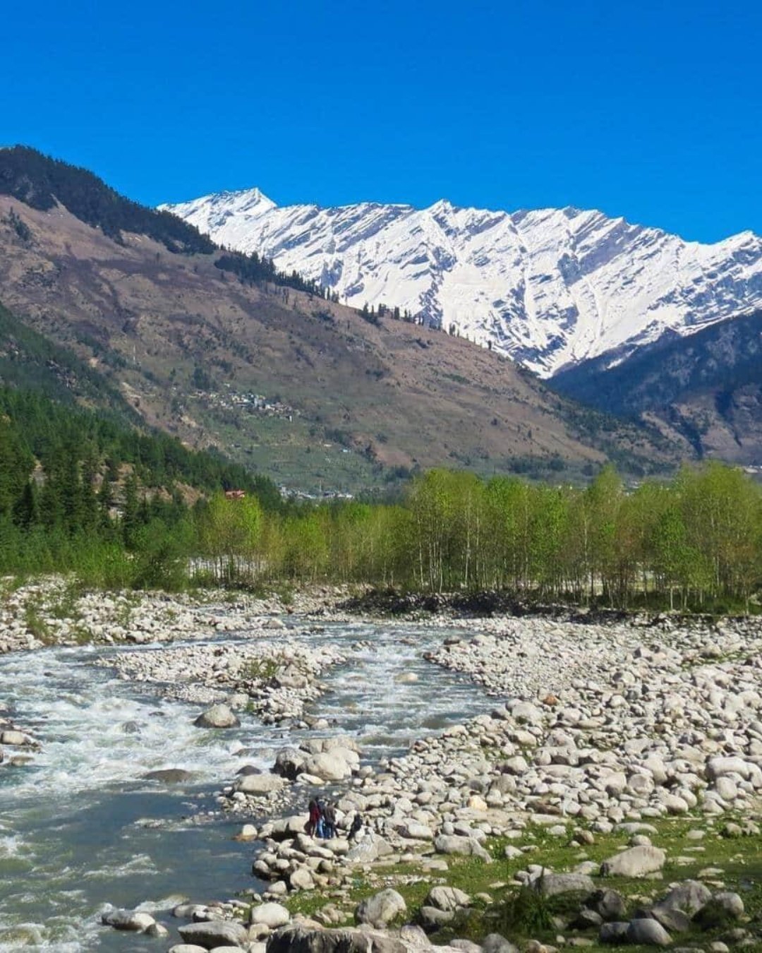
Manali sits at around 2,050 metres, more than 2,000 metres lower than Chandratal. You'll notice the difference almost immediately. Breathing feels easier, walking takes less effort, and after nearly a week in the high Himalayas, your body finally gets the chance to relax.
That's why Manali deserves more than a quick stop.
After days of mountain roads, basic camps, and remote villages, this is where you enjoy your first long hot shower, sleep in a comfortable bed, and savour a proper meal without worrying about the next pass or the next weather update.
Trying to squeeze in an evening flight from Bhuntar or a long drive immediately after descending only replaces that sense of relief with traffic, deadlines, and unnecessary stress. The mountains don't work to fixed schedules, and neither should your final day.
What you'll actually experience
The contrast with Spiti is what makes Manali memorable:
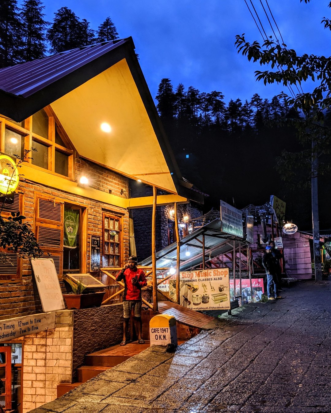
* Old Manali — cosy cafés, bakeries, music, and your first proper coffee after days in remote villages.
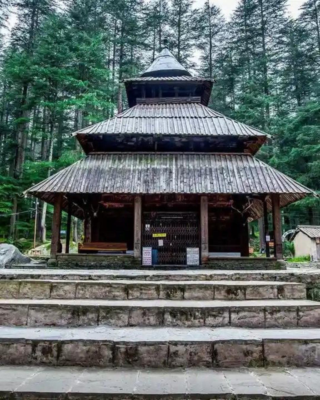
* Hadimba Temple — an ancient cedar-wood temple surrounded by towering deodar forests.
* Manu Temple — a peaceful hillside temple away from the busiest streets.
* Vashisht Hot Springs — warm mineral baths that feel especially rewarding after days in the cold Himalayas.
* Mall Road — lively markets selling Kullu shawls, Himachali caps, local handicrafts, and souvenirs.
You probably won't need your heavy down jacket anymore, but don't pack it too deeply until you've fully crossed into Manali. Weather near the Rohtang side of the Atal Tunnel can still change quickly.
And this is where your phone finally becomes useful again. Travellers often say the same thing: after days without reliable network coverage, Manali is where messages begin arriving all at once. Let your family know you've reached safely, back up your photos while you have Wi-Fi, and catch up with the outside world. Then put the phone away for one more evening. Sit in a café, enjoy the mountain air, and let the journey settle before everyday life takes over.
Pro tip: Always keep at least one night between arriving in Manali and any onward travel. Avoid booking evening flights from Kullu–Bhuntar on the same day you leave Chandratal. Mountain roads are unpredictable, and even small delays can snowball into missed connections. Spend your evening soaking in the Vashisht Hot Springs, enjoy a leisurely dinner in Old Manali, and if you're driving back to Delhi or Chandigarh, leave fresh the following morning instead of extending an already long mountain drive.
The mistakes that ruin the ending
Most first-time travellers make the same mistakes. They schedule tight onward connections and spend the final day worrying about the clock instead of enjoying the mountains. They skip an overnight stay in Manali and miss the recovery their body genuinely needs after a week at altitude. Or they assume the descent day will always go exactly to plan, only to discover that mountain roads have their own schedule.
The easy fix is simple: build in a buffer, spend one relaxed night in Manali, and let the journey end gently rather than in a rush.
Ready to say goodbye?
Manali isn't just the end of the Spiti circuit—it's the place where the adventure finally sinks in. After the monasteries, high passes, silent valleys, and star-filled skies, this is where you slow down, breathe deeply, and look back on everything you've experienced.
Want it handled end to end—a comfortable stay in Manali, flexible onward travel, relaxing hot springs, great cafés, and a perfectly paced itinerary from Shimla to Manali? Browse our Spiti Valley Tour Packages, where every stage of the journey is thoughtfully planned, from the first mountain road to the final farewell. Pick your dates and we'll take care of the ending.
20
Destination